

The legendary Inca Trail to Machu Picchu is widely recognized as one of the world’s most iconic trekking routes and also one of the most demanding adventures in Peru. Throughout the journey, hikers face an average elevation gain of roughly 1,000 meters (3,280 feet), reaching a challenging peak altitude of 4,215 meters (13,828 feet). Because of these tough conditions, travelers are strongly encouraged to reserve their permits well in advance and follow a proper physical conditioning program to safely handle the Inca Trail’s high-altitude environment and fully enjoy this unforgettable Andean experience.
Inca Trail Altitude
Hikers frequently encounter challenges along the Inca Trail, primarily due to its steep ascents and demanding high-altitude sections. For this reason, proper acclimatization is essential before starting the trek especially for travelers who are not accustomed to elevated environments. Taking time to adapt to the altitude can significantly improve your performance, reduce the risk of altitude sickness, and ensure a safer, more enjoyable Inca Trail experience.
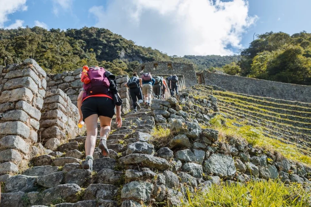
How high is the Inca trail?
The Inca Trail spans a remarkable range of altitudes, climbing from approximately 1,000 meters (3,280 feet) up to a breathtaking 4,215 meters (13,828 feet) above sea level. Its highest point, famously known as Dead Woman’s Pass, reaches 4,215 meters—nearly double the elevation of Cusco itself. This dramatic altitude variation is one of the reasons the Inca Trail is both iconic and physically demanding.
Therefore, trekkers should be prepared for an average elevation of around 3,000 meters (9,842 feet) throughout most of the route. This consistent high-altitude environment makes acclimatization and proper training crucial for a safe and successful hike.
We cross this challenging high point on the second day of the Inca Trail, and for many hikers, it becomes one of the toughest yet most rewarding moments of the entire trek.
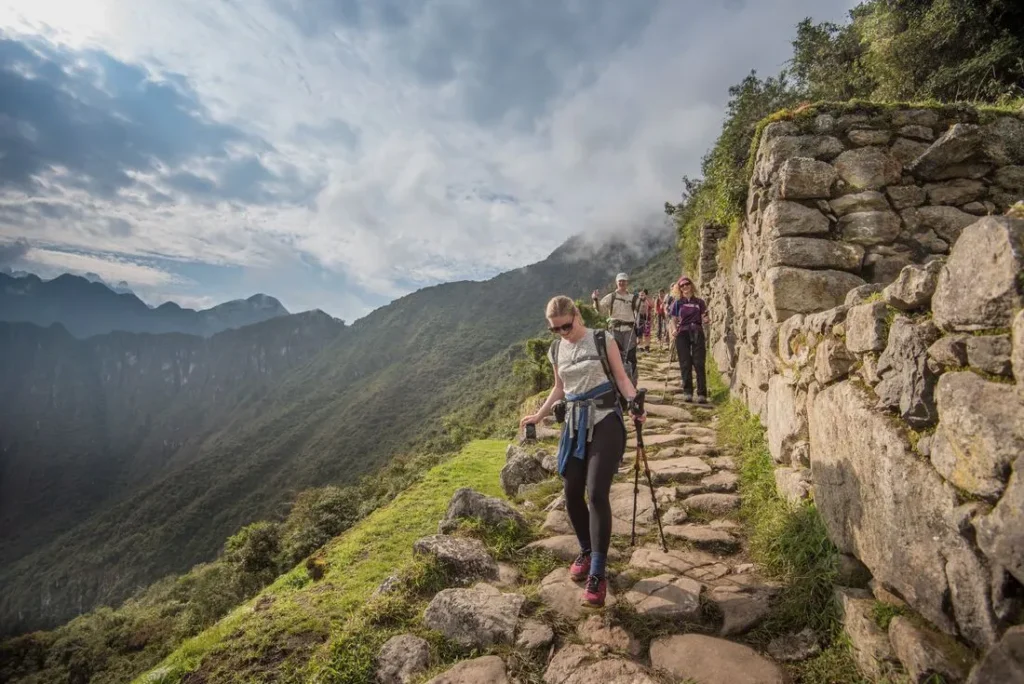
How long is the Inca trail?
The Inca Trail is considered one of the most challenging trekking routes in the world. This iconic four-day adventure unfolds across 26 miles (42 km) in Peru’s majestic Andes Mountains, taking hikers through rugged terrain, steep ascents, and ancient archaeological sites. With elevations soaring as high as 13,828 feet (4,215 meters), the trail’s difficulty becomes evident through its demanding altitude, variable weather conditions, and continuous physical effort required to complete the journey.
Inca Trail elevation points - day by day
Day 1 Inca Trail elevations
The Inca Trail features a series of dramatic elevation changes that highlight the demanding nature of this legendary trek. The highest point in the first section—near the Wayllabamba camp zone—stands at 9,842 feet (3,000 meters) above sea level. Throughout the hike, trekkers face:
- Elevation Gain: approx. 1,640 feet (500 m)
- Daily Descent: roughly 164 feet (50 m)
These altitude shifts clearly demonstrate why the trail is considered challenging. Proper acclimatization, a solid fitness routine, and awareness of altitude effects are essential for a safe and enjoyable journey.
Campsites along the Inca Trail are strategically positioned to help hikers gradually adapt to the increasing altitude. Below is a quick overview of key altitude points:
📍 Starting Point – Km 82
- 2,718 m / 8,924 ft
🏕️ Campsites
- Wayllabamba: 3,000 m / 9,842 ft
- Ayapata (preferred for Day 1): 3,300 m / 10,826 ft
🏛️ Main Archaeological Sites Along the Route
- Salapunku: 2,720 m / 8,923 ft
- Kanabamba: 2,625 m / 8,615 ft
- Wilkarakay: 2,650 m / 8,694 ft
- Patallacta: 2,614 m / 8,576 ft
- Wayllabamba Settlement: 3,000 m / 9,842 ft
These sites not only offer cultural and historical value but also serve as natural acclimatization points as trekkers continue deeper into the Andes.
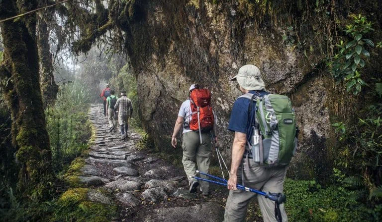
Day 2 Inca Trail elevations
Day 2 of the Inca Trail is widely known as the most demanding section of the entire trek, largely due to its steep ascents and extreme altitude changes. The highest point—Dead Woman’s Pass (13,828 ft / 4,215 m)—marks a major milestone for hikers. Throughout this intense day, trekkers face:
- Elevation Gain: approx. 3,610 ft (1,100 m)
- Total Descent: around 1,970 ft (600 m)
These elevation shifts make Day 2 both physically challenging and incredibly rewarding, offering some of the most dramatic views of the Andes. Acclimatization and proper pacing are essential to safely conquer this section.
Day 2 campsites and landmarks are strategically located to support hikers as they navigate the trail’s highest altitudes. Below is a clear breakdown of the key points:
🏕️ Campsites and Rest Stops
- Llulluchapampa: 3,800 m / 12,467 ft — first major rest stop of the day
- Pacaymayo Alto: 3,600 m / 11,811 ft — second designated campsite
- Chaquicocha: 3,600 m / 11,811 ft — preferred campsite for Day 2
⛰️ Important Mountains Along the Route
- Dead Woman’s Pass: 4,215 m / 13,828 ft — highest point of the entire Inca Trail
- Salkantay Mountain: 6,271 m / 20,574 ft — one of the most prominent peaks of the Vilcabamba range
🏛️ Archaeological Sites
- Runkuracay: 3,950 m / 12,959 ft — an ancient Inca lookout offering panoramic views
These locations help hikers gradually adapt to altitude while providing cultural insight and breathtaking scenery throughout the second day.
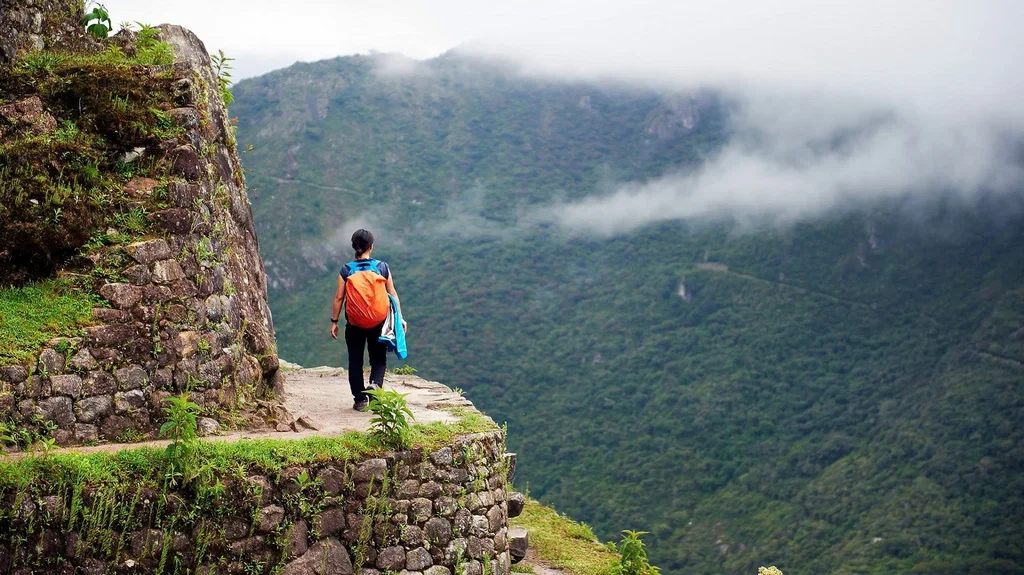
Day 3 Inca Trail elevations
Day 3 of the Inca Trail offers a blend of challenging elevation changes and some of the most breathtaking landscapes on the entire route. The highest point of the day—Runkurakay Pass (13,123 ft / 4,000 m)—marks the second-highest altitude of the trek. Throughout this section, hikers will face:
- Elevation Gain: approx. 1,476 ft (450 m)
- Total Descent: nearly 3,280 ft (1,000 m)
This dramatic descent leads trekkers deeper into the cloud forest, transitioning from rugged high-mountain terrain to lush, subtropical environments. Day 3 is often considered the most scenic day of the hike, as it combines sweeping mountain vistas, ancient ruins, and easier terrain after conquering the previous day’s toughest climbs.
Day 3 campsites, mountain passes, and archaeological sites offer hikers both cultural richness and strategic recovery points. Here’s a clear breakdown of the main altitude landmarks:
🏕️ Campsites
- Phuyupatamarca: 3,650 m / 11,975 ft — known as “the town above the clouds,” this is the third official campsite
- Wiñaywayna: 2,600 m / 8,530 ft — most preferred campsite for Day 3, offering warmer temperatures and proximity to Machu Picchu
⛰️ Key Mountain Pass
- Runkurakay Pass: 4,000 m / 13,123 ft — the second-highest point on the Inca Trail and a major milestone for trekkers
🏛️ Archaeological Sites Along Day 3
- Sayacmarca: 3,600 m / 11,811 ft — an impressive Inca fortress with panoramic views
- Conchamarka: 3,550 m / 11,646 ft — a smaller but fascinating ruin connected by ancient stone pathways
- Phuyupatamarca: 3,650 m / 11,975 ft — one of the best-preserved ceremonial complexes
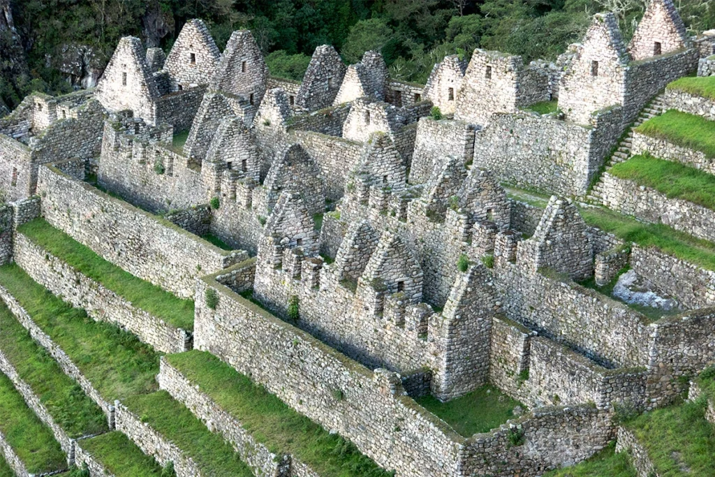
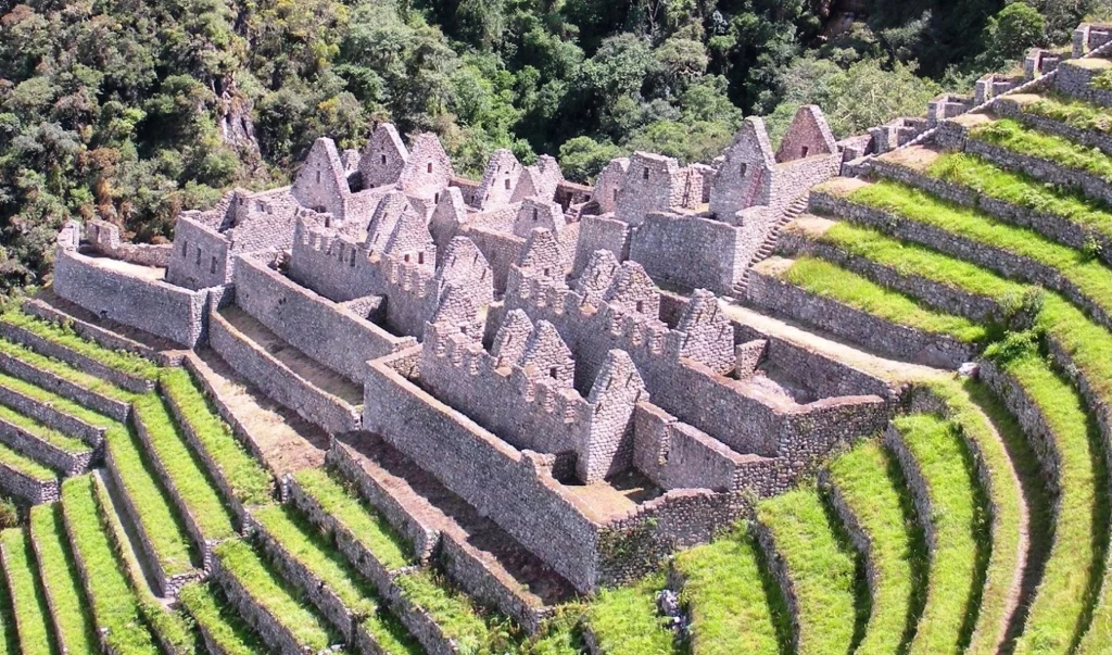
- Intipata: 2,840 m / 9,317 ft — extensive agricultural terraces overlooking the valley
- Wiñaywayna: 2,600 m / 8,530 ft — one of the most beautiful and iconic ruins before reaching Machu Picchu
Day 4 Inca Trail elevations
Day 4 of the Inca Trail marks the exciting final stretch toward Machu Picchu, offering a combination of gentle elevations and a rewarding descent into the iconic ruins. The highest point of this day is the legendary Sun Gate, or Inti Punku (8,858 ft / 2,700 m)—the very spot where hikers get their first breathtaking view of Machu Picchu at sunrise. Elevation changes on this last leg are more manageable compared to previous days:
- Elevation Gain: approx. 1,476 ft (450 m)
- Total Descent: around 492 ft (150 m)
These softer gradients allow trekkers to enjoy the scenic transition from cloud forest paths into the majestic archaeological zone, building excitement for the final arrival at Machu Picchu.
Day 4 also features key campsites, mountain viewpoints, and world-famous archaeological sites that complete the Inca Trail experience. Below is a clear breakdown of the essential landmarks:
🏕️ Campsite
- Puente Ruinas: 2,000 m / 6,561 ft — the final campsite used in extended 5-day itineraries
⛰️ Mountains Visible from the Final Stretch
- Pumasillo Mountain: 5,991 m / 19,656 ft — an impressive snow-capped peak seen from Machu Picchu
- Machu Picchu Mountain: 3,082 m / 10,111 ft — the highest mountain overlooking the citadel
- Huayna Picchu Mountain: 2,693 m / 8,835 ft — the iconic peak seen in classic photos of Machu Picchu
🏛️ Archaeological Sites on Day 4
- Sun Gate (Inti Punku): 2,700 m / 8,858 ft — the ancient entrance to Machu Picchu and the first viewpoint for trekkers
- Machu Picchu Citadel: 2,430 m / 7,972 ft — the crown jewel of the Inca Trail and one of the New Seven Wonders of the World
Inca Trail difficulty
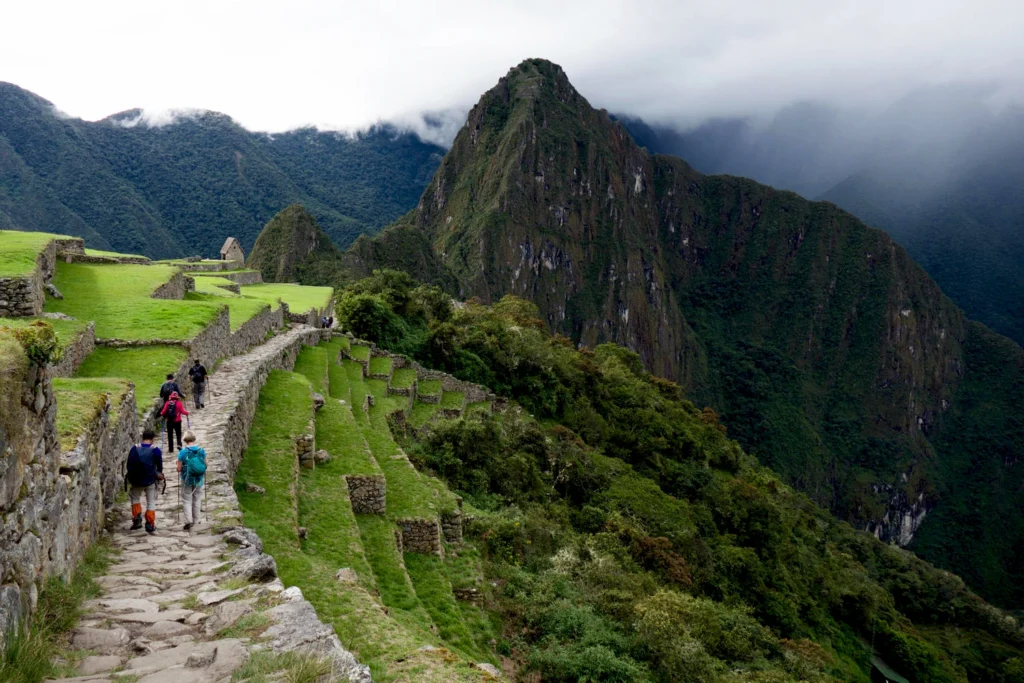
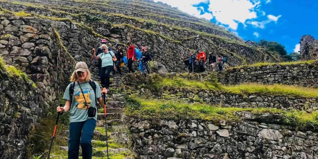
The Inca Trail to Machu Picchu is known for being an epic and challenging hike, featuring steep inclines and sudden changes in altitude. It also can be quite steep, reaching 30% or steeper grades at times. At such heights, air density drops dramatically. So, some may experience shortness of breath, fatigue headaches, or nausea and vomits from being at such altitude. Therefore, trekkers should come prepared.
But don’t afraid, despite its difficulty, the Classic Inca Trail hike to Machu Picchu can be enjoyed by most moderate and experienced hikers. Before beginning this trek, all necessary preparations must be made before embarking upon it.
Inca Trail altitude sickness
Altitude sickness—commonly called Soroche—is a frequent condition that affects travelers who ascend to high elevations too quickly, particularly above 2,500 meters (8,200 feet). Typical symptoms include headaches, nausea, dizziness, fatigue, and difficulty breathing, all caused by the reduced oxygen levels at higher altitudes. While usually mild, these effects can make the beginning of any trek uncomfortable if you’re not properly prepared.
Acclimatizing to the Inca Trail’s altitude before starting the hike is absolutely essential, especially for those who are not used to high elevations. Proper preparation can dramatically improve your comfort, safety, and overall experience on the trail. Below are several practical tips and effective strategies to help you get ready for the altitude and enjoy a successful trek to Machu Picchu.
Tips to Acclimate to the Inca Trail High Altitudes
• Take it slow
Spend a night or two at a mid-level altitude before going higher on the Inca Trail.
Cusco (3,550 m / 11,646 ft) is an excellent place to acclimatize.
Giving your body time to adjust helps reduce the risk of altitude sickness.
• Prioritize rest
Make sure you get a full night’s sleep before starting the hike.
Take short naps or enjoy quiet, relaxing activities in the days leading up to the trek.
Resting well helps your body adapt faster.
• Stay hydrated
Drink plenty of water throughout the day.
Avoid coffee and alcohol, as they cause dehydration.
Staying hydrated is one of the most effective ways to minimize altitude symptoms.
• Eat smart
Choose light meals, especially carbs and vegetables.
Avoid heavy foods high in fat or protein, as they’re harder to digest at high altitude.
Eating clean and simple helps your body adjust more easily.
• Pay attention to how you feel
Listen to your body and keep an eye on your travel partners.
If symptoms worsen—such as headaches, nausea, or dizziness—seek medical help immediately.
Early response prevents mild discomfort from turning into severe altitude sickness.
Inca Trail weather
🌧️ Inca Trail During the Rainy Season (December – March)
From December to March, Cusco enters its rainy season. Expect daytime temperatures around 18°C (64°F) and cooler nights averaging 9°C (48°F).
🚧 Important: The Inca Trail is closed in February for maintenance, but you can still hike it in the surrounding months—with a few trade-offs.
✔️ Pros:
- Fewer tourists on the trail
- A quieter, more peaceful hiking experience
❌ Cons:
- Wet and muddy trails
- Colder, unstable weather
🎒 What to pack:
- Waterproof jacket
- Rain cover for your backpack
- Waterproof hiking boots
If you’re comfortable hiking in rainy conditions, this season can still offer an incredibly unique and serene adventure.
☀️ Inca Trail During the Dry Season (May – September)
The dry season is the most popular time to hike the Inca Trail. Weather is typically pleasant with minimal rainfall. Daytime temperatures average 16°C (61°F), while nights can drop below 0°C (32°F).
📌 Keep in mind:
- This is peak tourism season.
- Inca Trail permits sell out quickly—book months in advance.
- Expect larger crowds at Machu Picchu and longer lines for buses and trains in Aguas Calientes.
✔️ Pros:
- Clearer skies
- Dry, stable weather—ideal for photography and hiking
❌ Cons:
- Freezing nighttime temperatures
- Heavy tourist traffic
If you prefer predictable weather and don’t mind crowds, this is the best time to hike.
🍃 Inca Trail During the Shoulder Seasons (April–May & September–October)
The shoulder seasons are often considered the ideal time to hike the Inca Trail. During April–May and September–October, the weather becomes more balanced—less harsh than the rainy season and less crowded than peak months.
🌤️ Weather benefits:
- Mild daytime temperatures
- Cooler but not freezing nights
- Light rain possible but not as heavy as December–March
👣 Why hikers love this season:
- More comfortable trekking conditions
- Fewer crowds
- Great mix of clear skies and lush landscapes
If you’re looking for the perfect balance of good weather and fewer tourists, shoulder season is the best choice.
How to prepare yourself before Inca Trail
- Prepare your body: Go for daily walks of one to two hours near your home. If you can find areas with an incline, even better.
- Eat healthy: Eat carbohydrate-based meals and vegetables a few days before your hike. These will give you energy and lightness to tackle the Inca Trail altitude.
- Dress properly: To have a great hiking experience, buy comfortable hiking shoes, rain gear, a day pack, and other essentials soon. This will help you handle the weather and terrain of the Inca Trail.
- Book Your Spot: As one of the world’s premier treks, the Inca Trail quickly fills up. If you wish to hike this magnificent trail, book early your Inca Trail permission as spots often sell out quickly.
- Learning some basic Spanish: When you travel the Inca Trail, you might meet people who only speak Spanish. So, knowing some basic phrases can make your trip more enjoyable.
Inca Trail Permits 2026: What You Need to Know Before You Book
Hiking the legendary Inca Trail is not something you can simply show up and do. Because the trail runs through the protected Machu Picchu Historical Sanctuary, it’s regulated under a strict conservation program designed to minimize environmental impact and preserve the ancient stone pathway. Access is tightly controlled by Peru’s Ministry of Culture, which oversees all permits and visitor numbers.
Independent trekking isn’t allowed on the Inca Trail. Every traveler must join a licensed tour operator authorized by the government. These agencies handle everything for your trek—your official Inca Trail permit, professional guide, porters, camping gear, meals, and all necessary logistics.
Reserve Early—Permits Are Extremely Limited
Securing your spot is all about timing. Only 500 permits are issued for the trail each day, and this figure includes support staff such as porters, cooks, and guides. That means typically only 180–200 permits are available for hikers, making early reservations essential.
The booking window for Inca Trail 2026 is now open, and spaces are disappearing quickly. If you’re hoping to complete the classic 4-day route to Machu Picchu, lock in your dates as soon as possible. Have your passport details on hand for the reservation, and keep in mind that permits are non-refundable and non-transferable—so double-check your travel plans before confirming.
Final Tip
If trekking this iconic route is on your bucket list, don’t wait—secure your Inca Trail 2026 permits now and guarantee your place on one of the world’s most famous hikes.